The name ‘‘North Ferriby’’ (meaning place of the ferry) denotes that it was a Danish settlement of about AD 900.
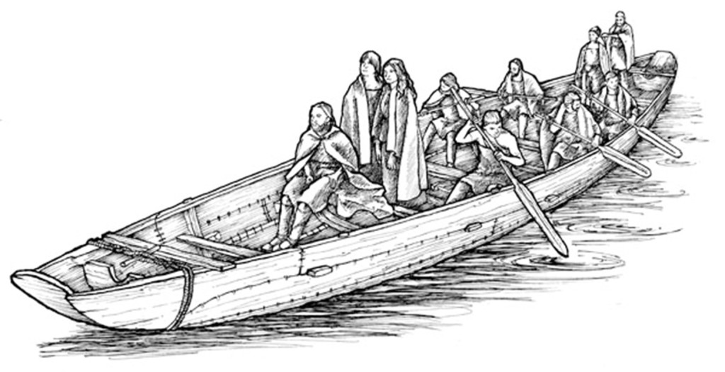
There is evidence of earlier activity in the Bronze Age from the discovery near the village of what are the oldest known plank-built boats known in Europe.
Just to the west of the village are the traces of an Iron Age settlement.
The church was founded before 1086 AD and later there was a Priory. In the 18th and 19th centuries, Hull merchants built fine houses in the High Street.
Directions are given in this typeface to distinguish them from the main commentary.
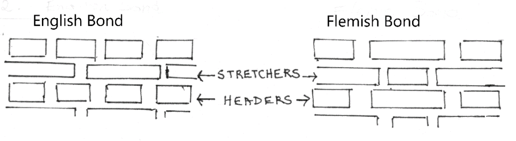
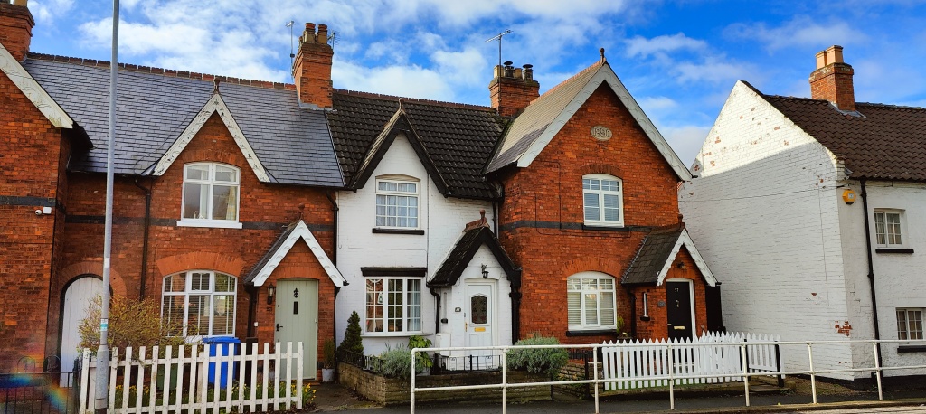
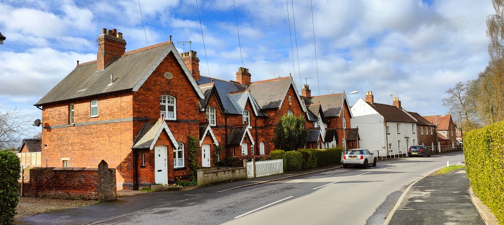
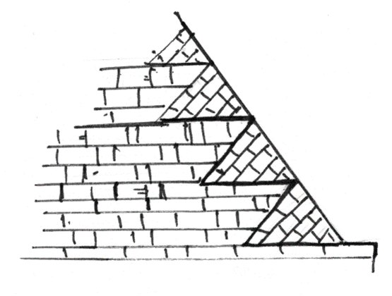
As you walk around the village admire the many fine buildings, old and new. Also try to identify the varying styles and ages of the brickwork. Older bricks were much smaller (about 2’’ deep). Beige coloured bricks are typical of mid-19th century building. Note the different bonds of the brickwork.
English Garden Wall Bond, of which there are many examples (also in cottage walls) has 3 to 7 rows of stretchers between each row of headers.
This trail starts at No. 1 on the map, opposite the Co-op.
Each numbered paragraph represents a location on the village map at the end of this document. Names of buildings which still exist are in CAPITALS, those that have been demolished or otherwise lost are simply Bold.
The full length of the trail is a little under 3 miles and should take about 1½ hours.
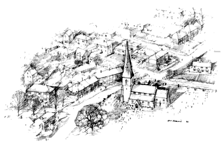
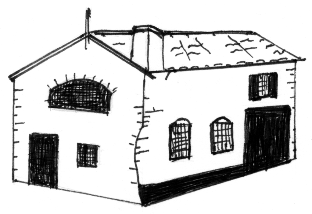
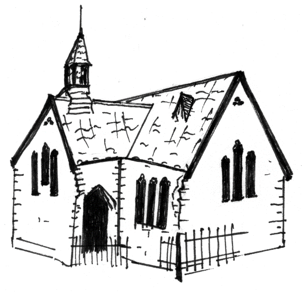
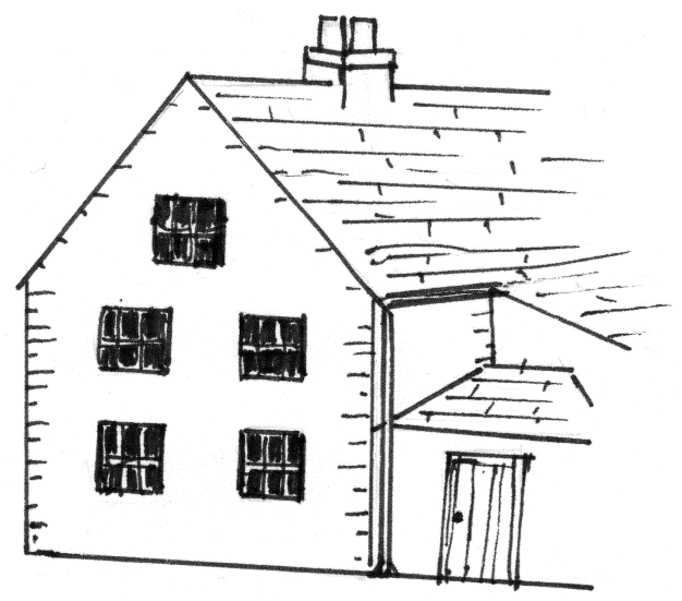
For the most part, Kay Laister’s charming line drawing from the original version of the trail have been retained.
NORTH FERRIBY may be reached via the A63 from the west (Welton etc.) and from the east (Humber Bridge, Hessle) or from the north through Swanland. Grid reference: 53.7213403, -0.5171256
Maps of the trail (click to open)
Start from the crossroads and head west along High Street to the first grand building on the left. We suggest using the zebra crossing to move to the north side of the road.
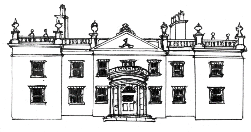
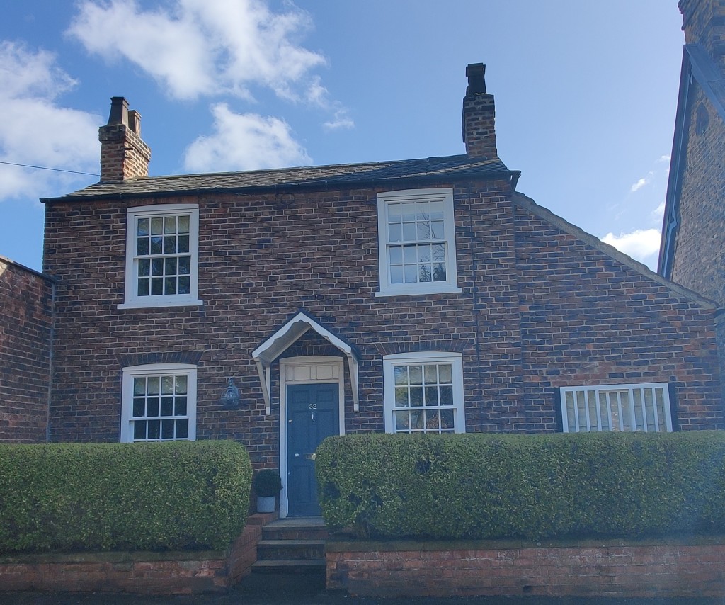
1. FERRIBY HOUSE. This fine, three-storey Adam-style house was rebuilt (in Flemish bond) for Sir Henry Etherington, a Hull merchant, Sheriff and Mayor, about 1775. The interior is said to be of exceptional quality, with elaborate plasterwork. By the 1850s, the house belonged to the Turner family, who later acquired a large part of the village. Note the curve of the brick wall opposite, showing that the road was diverted (until the 1920s) so the house was set back from it.
2. FERRIBY GARTH was built in the 18th and 19th centuries. You can see from the brickwork of the garden wall that the house formerly extended to the road. The corner building, adjacent to the High Street, was the stable block for Ferriby House.
3. The MANOR HOUSE at 1 Woodgates Lane dates from about 1800, probably replacing an earlier house. It has 19th and 20th century extensions and is now attractive apartments.
4. Aston Hall Drive and a piece of old garden wall further on show the site of AstonHall (Demolished 1970). This house, first built in the late 17th century, was rebuilt circa 1740 by William Wilberforce, grandfather of the anti-slavery campaigner; wings were added about 1839. In the late 19th century it was the home of Sir Frederick A.T. Clifford Constable of Burton Constable. Next door was Trinity House Farm, part of which may have dated from about 1700. (Demolished about 1960).
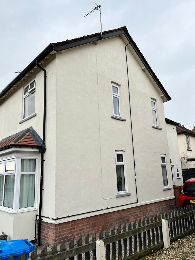
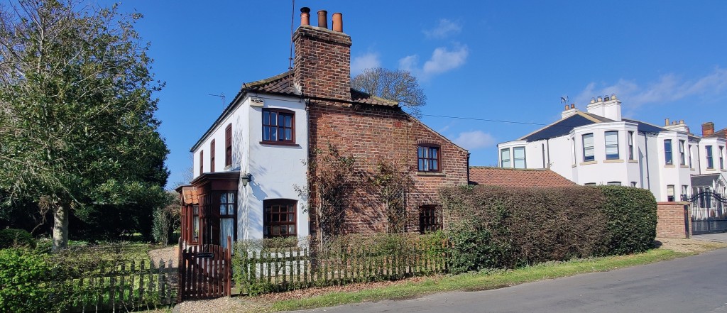
5. THE COTTAGE (2 Melton Road) has a Victorian front and a Georgian rear. No 4 Melton Road was THE LODGE of a large house, built in the 1870s (now demolished) and called variously M(N)elholme, Sunnymede and Ferriby Lodge.
Cross High Street and head back the way you came.
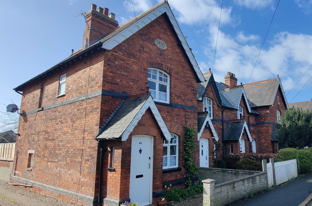
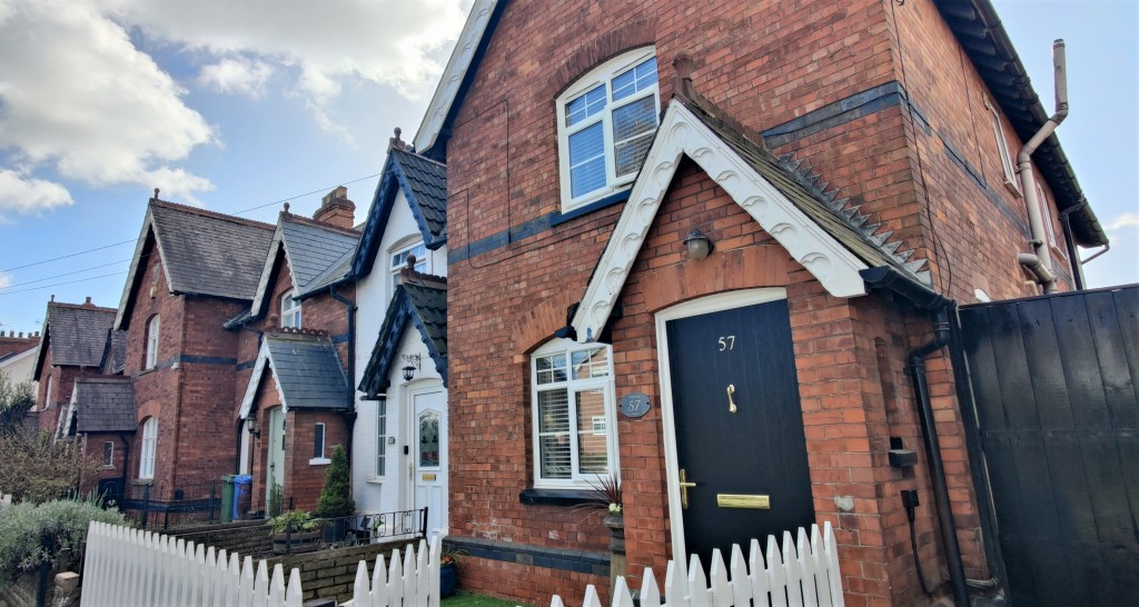
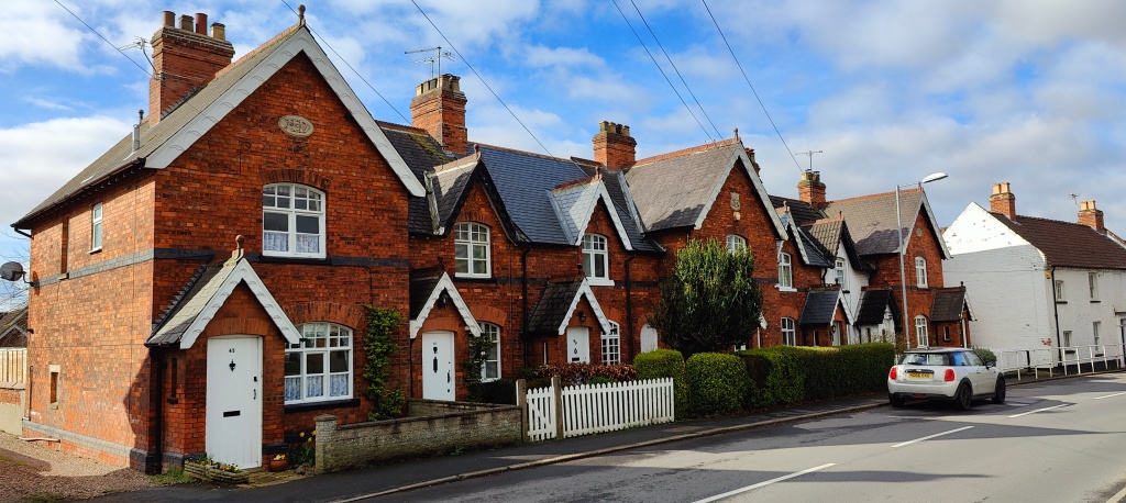
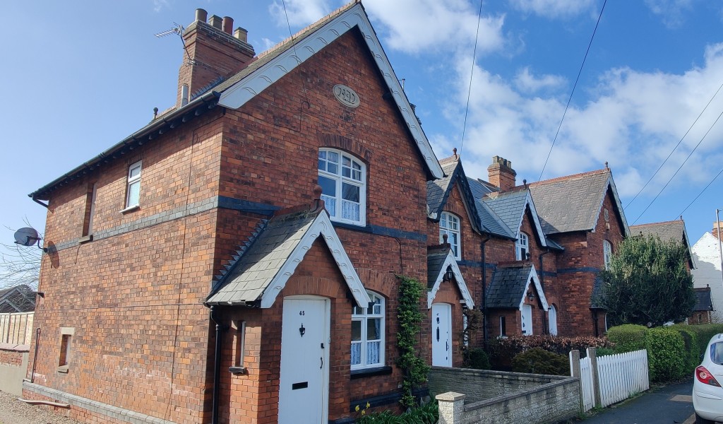
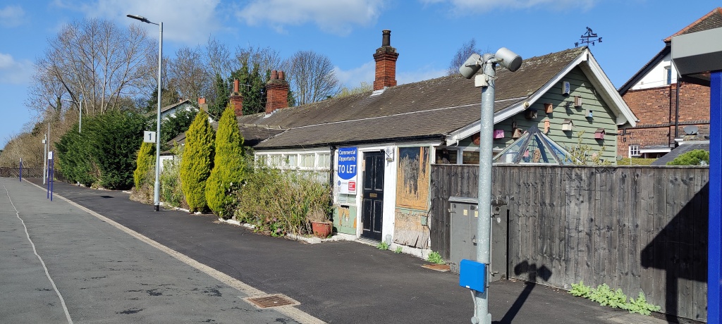
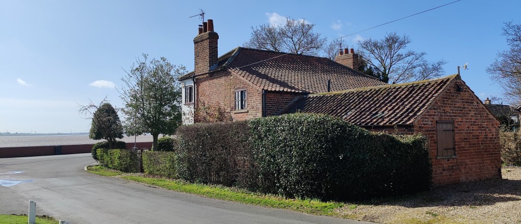
6. Nearly opposite is WHITEHOUSE FARM, built in the mid to late 18th century. The left bay of the house was added later; this has two sideways-sliding sash windows (so-called Yorkshire sash). The doorcase is 19th century; the roof is pantiled. The property, including the Horse Mill, was converted in the 1990’s. The 7 cottages Nos. 45-57 HIGH ST were built in 1890 by Anne Turner of Ferriby House (see plaques on gables).
7. Pass the early 20th century houses to the METHODIST CHURCH which was built in 1877 by the Primitive Methodists to replace the chapel in Narrow Lane. The Schoolroom behind was added in 1883 and the chapel’s interior was altered in 1938.
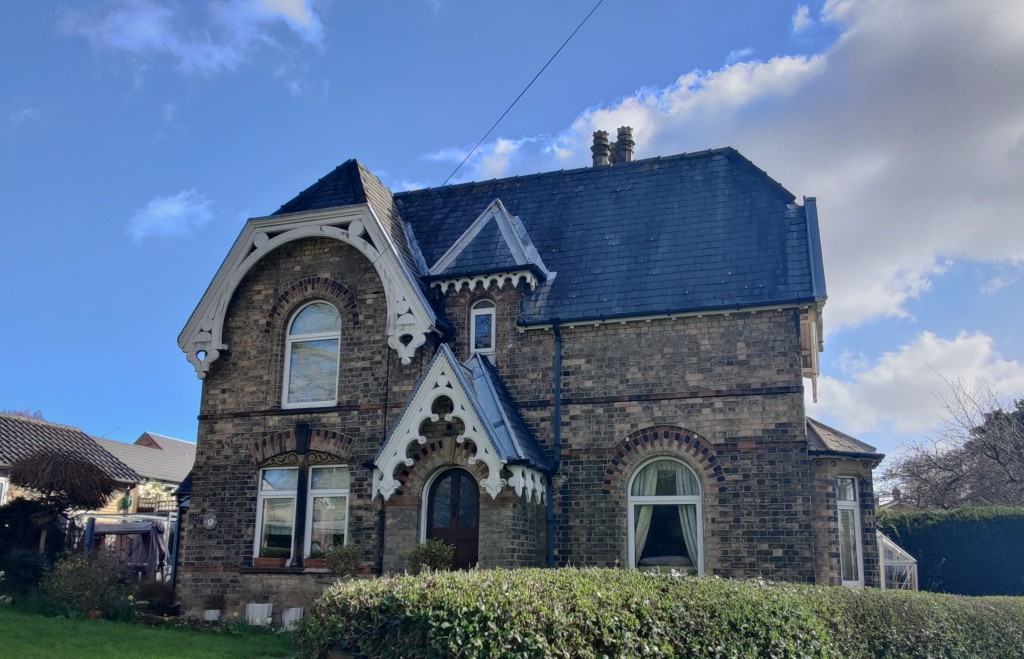
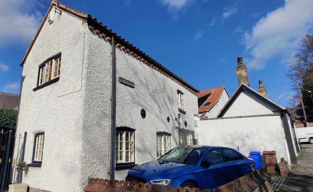
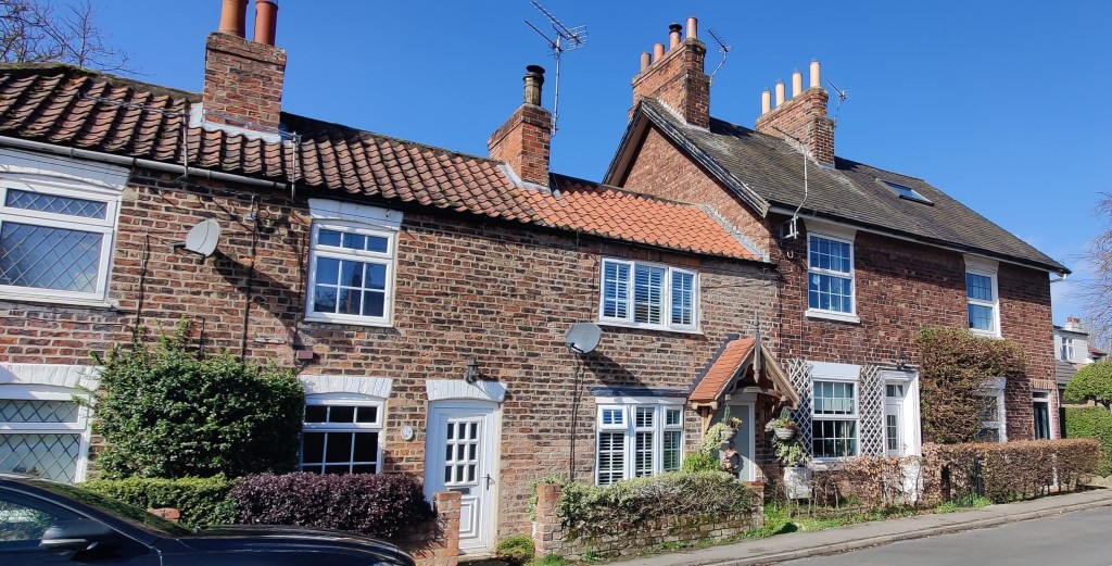
LOW TIMBERS (No. 15) has the date 1758 date on its door lintel. It is built of brick, roughcast and colour washed, with a pantile roof and central lobby entrance. Note the two Yorkshire sash windows.
Turn right onto Narrow Lane
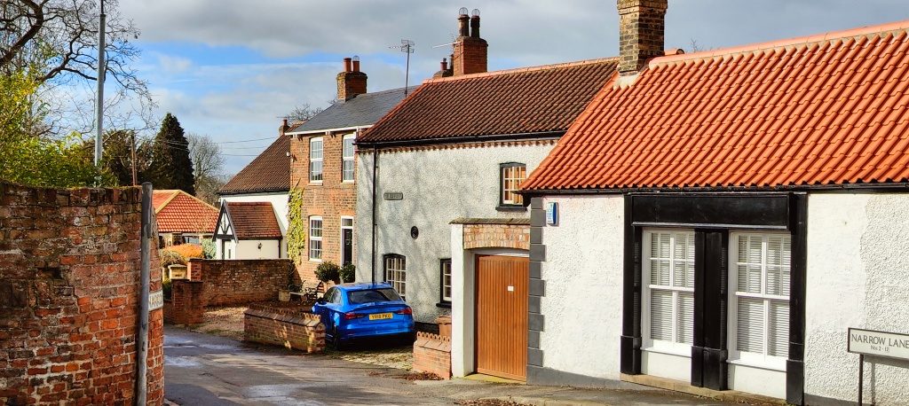
8. In Narrow Lane (also known as Narrow Racket by the elder residents of the village and is an ‘‘ancient lane’’) is the OLD FORGE, which closed as a business about 1939.
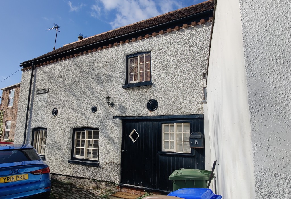
No. 6 was built around 1840. Next is the former PRIMITIVE METHODIST CHAPEL (built in 1828), now converted into a house; surprisingly it seated 100! For many years from 1883 it was the Oddfellows Hall and this name has been re-established in recent years. Next door was Old Farm, formerly Woodgate Farm, dating from the mid to late 18th century.
Continue down Narrow Lane to Station Road, by the old brick wall. This lane used to lead all the way to the landing on the Humber prior to the arrival of the railway in 1840. It was formerly called Humber Road.
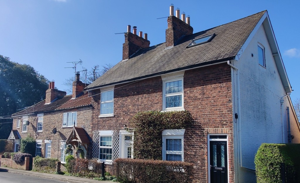
9. FERRIES CORNER (No. 38) probably dates from the early 19th century, with 20th century additions. Notice the Yorkshire sash windows. The slope roofed extension to No. 32 was the National School, built in the 1820s. In 1868 the school moved to new premises next door, Nos. 28 and 30.
10. Opposite the National School buildings is No. 43 is the former VICARAGE built in 1847.
11. HONEYSUCKLE and MOSS COTTAGES, originally three cottages, were built by Sir Henry Etherington of Ferriby House for some of his workers; at one time there were two front porches. The gables have Yorkshire sash windows.
Evelyn Gardens, a modern development, used to be a track that led passed The Grange to the church.
Parkfield Avenue, dating from 1910, was named after one of the medieval open fields. Here and at the end of Marine Avenue there were big gates.
Cross Parkfield Avenue towards the station
12. No. 1 STATION ROAD the Station-Master’s House was redeveloped as ‘‘a neat and convenient edifice’’ in 1840, when the station, on the new Hull-Selby Railway, was opened. Originally there was a level-crossing here. Note the old station buildings.
Walk over the pedestrian bridge to Humber Road. Note this is not wheelchair/mobility friendly. There was a grocery shop/bakery at 2 Humber Road, facing the railway until 1936. You can still make out the overpainted sign ‘Parkfield Store’ on the gable end.
13. Nos. 1 to 11 Opposite were built for railway workers in the first decade of the 20th century. The five cottages on the right, Nos. 8 to 16, probably date from about 1840. Further on are both 19th and 20th century houses.
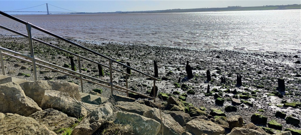
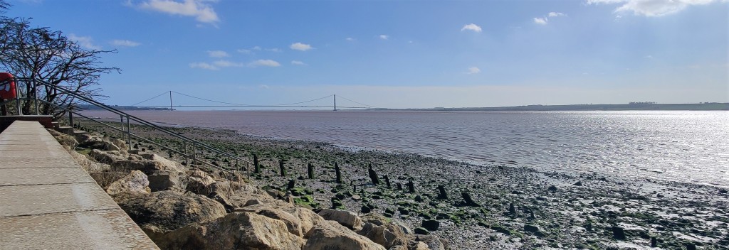
14. The last house on the right is MARINE COTTAGE. probably built in 1837. By then there was a Landing Stage here, in use until the 1920s. Take in the views across the Humber.
15. On the left (East) of Humber Road, where modern housing has been built, are INGSFIELDS. This was medieval pasture, fertilised by brackish water infiltrating from the Humber; it provided good grazing for cattle as well as crops of hay. It is rich in wildlife (see notice board) and one of the very few such areas left, and of some historical importance as a consequence.
Walking along the beach or path across the field brings one to the REED POND. Here is the site of Ferriby Brickyard and Jetty which were in operation from 1874 to about 1920. Alternatively, head back to Ings Lane and walk down the track by the pond or the unmarked lane just before the railway bridge to access locations 16 – 18.
16. Near here, in the clay at the edge of the Humber, the remains of 3 boats, one now dated to about 2,000 B.C., were discovered by Edward Wright. They appear to have been made from oak planks, sewn with yew withies. A half scale replica was built and remains in the village.
17. This is land (formerly a refuse tip) which belongs to the Riding for the Disabled Association, and the RIVERSIDE WALKWAY, bought by the Parish Council in 1987. This covers 22 acres; paths have been made and trees and flowers planted since its acquisition. This is part of the Wolds Way and provides a popular walk to Hessle Foreshore and Humber Bridge.
Pass under the railway bridge, HUL1/17 – the 17th bridge on the line from Hull station. Note how wide the bridge is, anticipating further lines being added. There used to be sidings adjacent to this area.
18. The buildings before the bridge are the late 19th century BRICKYARD COTTAGES. Beyond the railway bridge are the ANNE TURNER MEMORIAL ALLOTMENTS (note the plaque on their gate) and the PLAYING FIELDS, both donated to the village by her in 1895, with the current location being established in 1904.
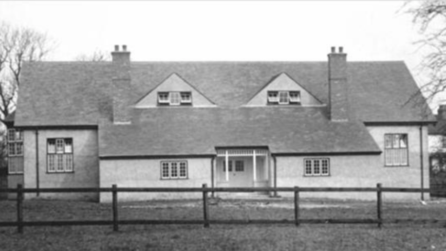
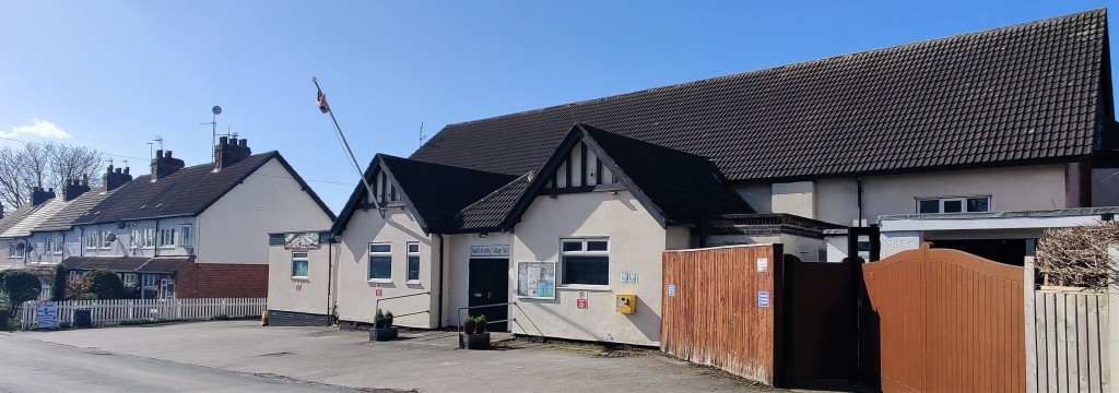
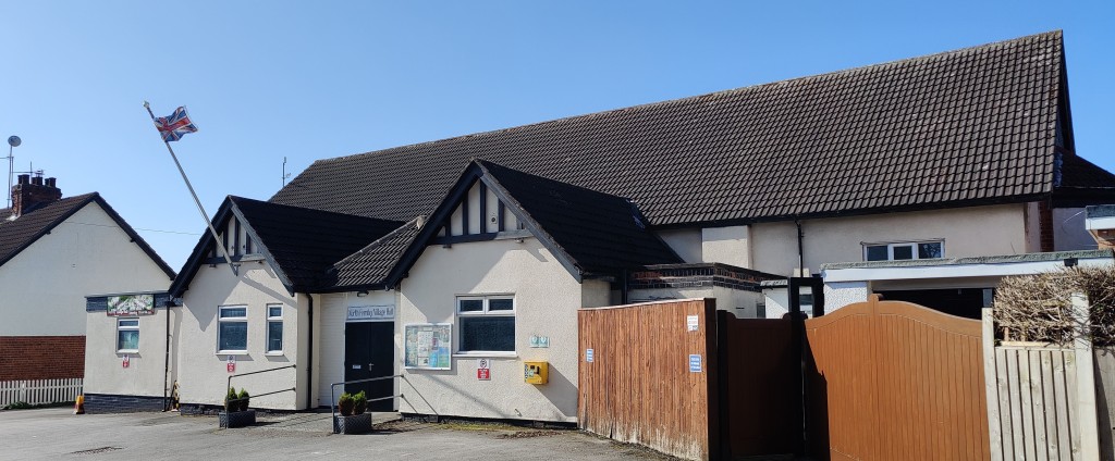
Further along, on the left, is Priory Avenue which was part of the site of Ferriby Priory of the order of the Knights of the Holy Sepulchre, founded about 1150. Most of the priory site was to the north of what is now New Walk. By 1291 it was occupied by the Canons of St. Augustine and was dissolved in 1536. A number of ponds had provided fisheries. By the 17th century (on this site) there was a Hall which later belonged to the Lillingstones. Described as “a princely mansion”, one room had mirrors to reflect the view of the river. FERRIBY VILLAGE HALL is an active centre of current and past village life. It re-opened in 1949, following wartime use and restoration, replacing the Estate Hall of 1914.
Turn left into New Walk and look across the lawn to the north
19. No. 8 NEW WALK was part of Ferriby Grange, the farm belonging to the Priory; the building probably dates from the mid-17th century. The road itself dates from the 1920s.
Return to Church Road and turn left (North)
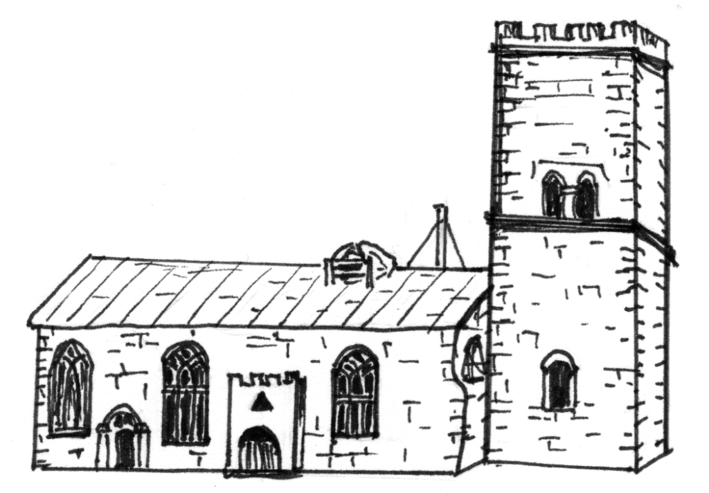
20. The first stone built CHURCH OF ALL SAINTS dated from the late 12th century. It was rebuilt in 1848/9, the architect being John L. Pearson R.A. It contains several monuments, including those of the Lillingstone, Etherington and Pryme families. Outside, near the south door, there is a medieval cross base. The Turner family monument lies within the cemetery
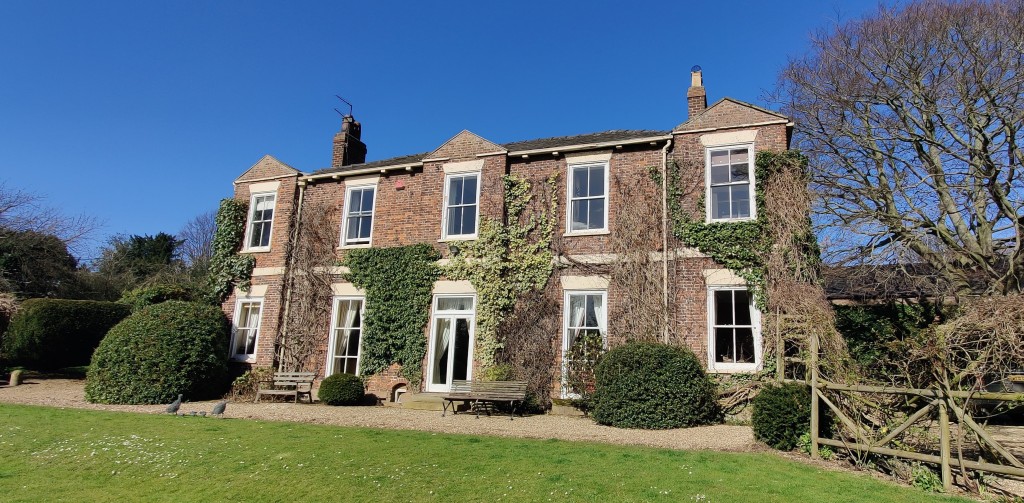
21. No 25, THE GRANGE (originally Grange Farm) was built in about 1770. Once it belonged to the Mayor and Burgesses of Hull and was called Corporation Farm.
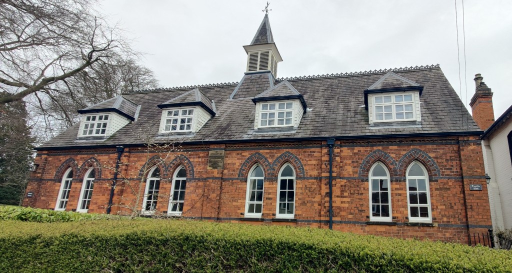
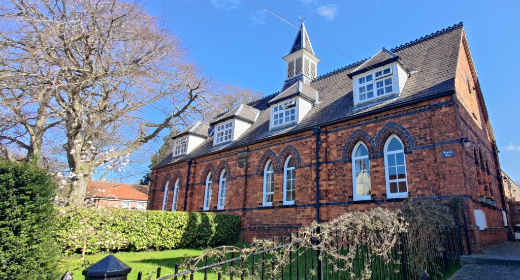
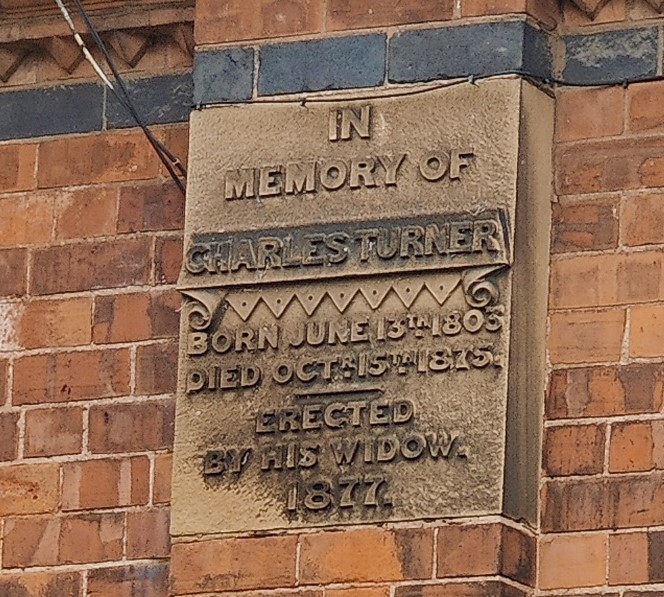
22. SCHOOL HOUSE, now comprising 2 homes named Pupil End and Master House bears a plaque to the memory of Charles Turner M.P It was erected in 1877 and closed in 1990. It. The school bell has been preserved in its replacement, the present North Ferriby Church of England Primary School, a little further up the road. The LIBRARY, built on land given by Major Ringrose of Tithe Farm, was opened in 1935. Opposite were the Glebe (the site of the original Vicarage) and the Pinfold.
Turn left onto School lane and proceed to the corner with Reading Room Yard
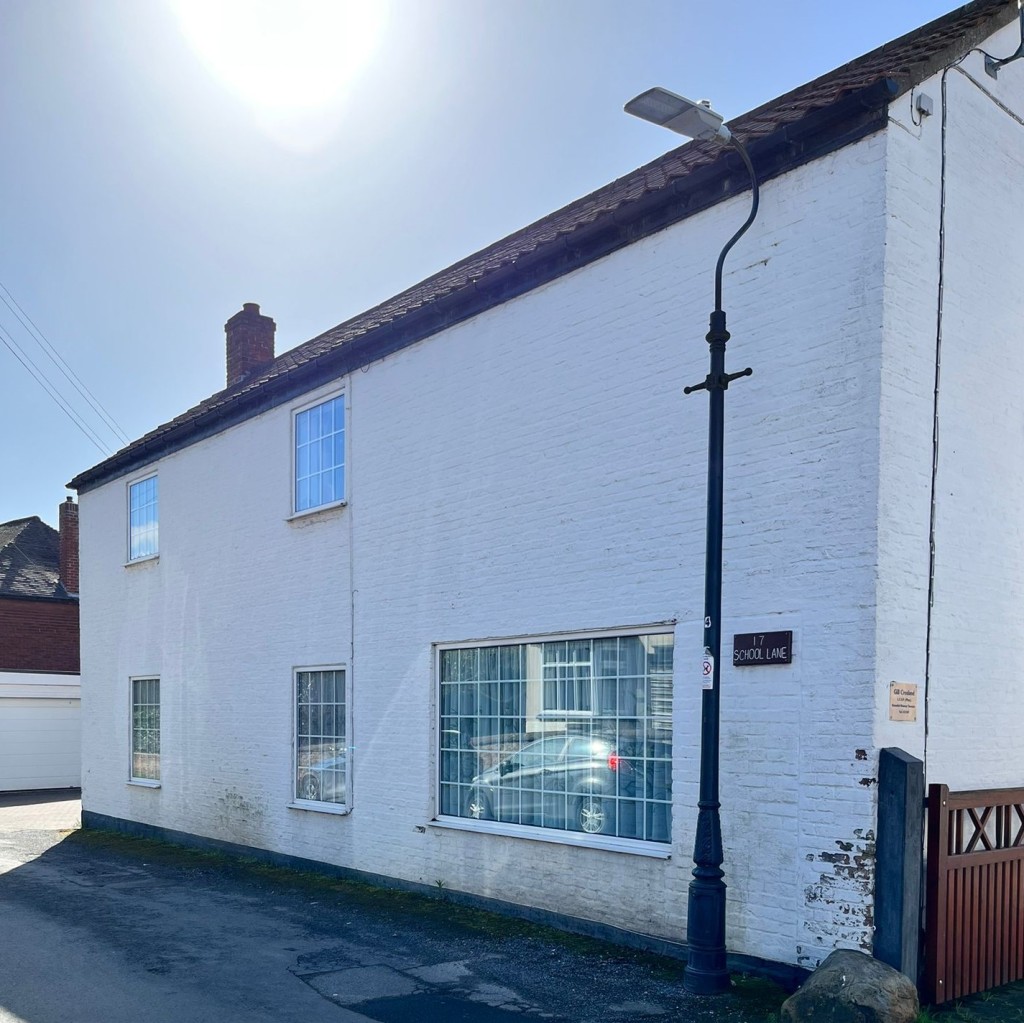
23. No 17, for many years a greengrocer’s shop, was altered in 1979. No 5 LOW STREET was the Reading Room from the 1890s to 1920s. Between this and No. 3 is the entrance to Reading Room Yard, where Nos. 1, 2 & 3 were built in 1882, (plaques on the south facing gable show this).
Turn left up Low St.
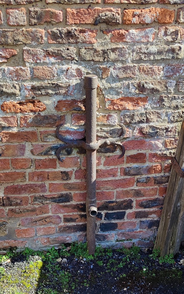
24. Opposite No. 7, notice the remains of a pump. Nos. 2 & 4 replaced 3 older cottages. There was much alteration in this street during the 20th century. No. 21 has brick tumbling on the gable, as has No. 12, which was the Post Office from about 1890 to 1926.
Opposite the Ferriby Social Club (previously the British Legion) is the former studio of well-known local artist, Tom Harland; commemorated with a gable end plaque.
Turn right into Turner’s Lane.
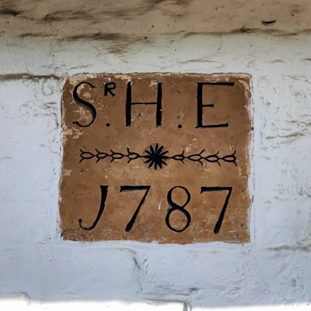
25. On the right is the TELEPHONE EXCHANGE, built in 1788 as stables for Ferriby House. Notice the bull’s eye windows, cupola and weather vane. At the top of the lane, on the left, is THE COACH HOUSE, built about 1850 for Ferriby Garth and converted in 1955.
Cross the High Street to the corner with Woodgates Lane.
26. No. 22 High Street was the Post Office from about 1926 to 1936. The older cottage, No.20, served as the Telephone Exchange for about 50 years.
27. Nos. 12 & 14 were formerly one house, The Uplands, built by the early 18th century and later inherited by Lady Deerhurst, Countess of Coventry.
28. THE DUKE OF CUMBERLAND pub was built about 1930 to replace an older building at the roadside.
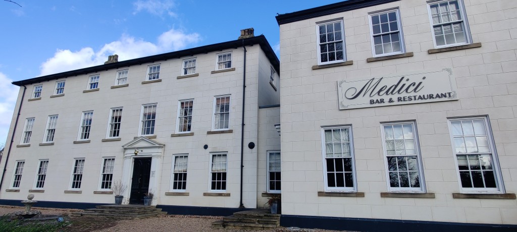
29. FERRIBY HALL was probably first built about 1696 for Robert Carlile, Mayor of Hull, but rebuilt in the early 1800s. The grounds had yew hedges and an obelisk dated 1763. It was bought by Lord Nunburnholme in 1904, later becoming a Country Club (now a restaurant with two floors of offices above and an active squash club to the rear).
30. The house of TITHE FARM dates from about 1790 or earlier. Until the Turnpike road was built in 1825, there was a green in front of the house.
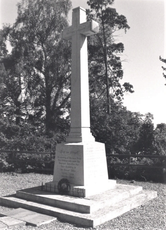
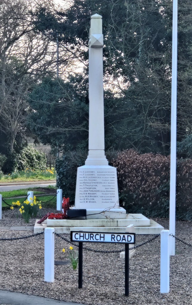
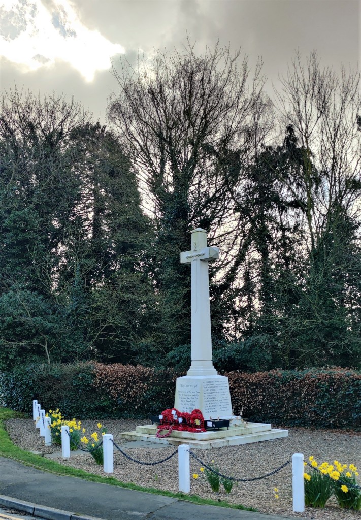
Opposite is the WAR MEMORIAL, which was unveiled on the 12th June 1920 in the presence of Lord Nunburnholme and the Bishop of Hull. It bears the names of 36 people and is a grade 2 listed monument.
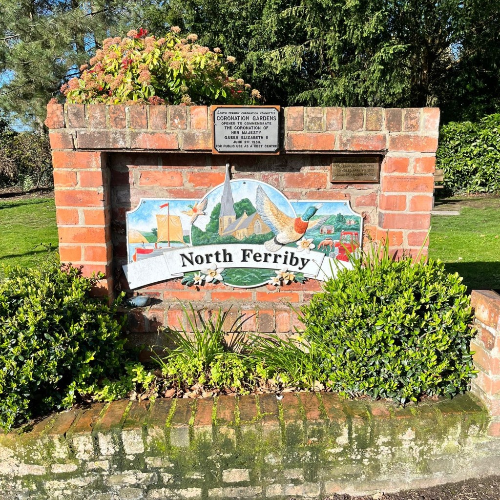
Facing this is CORONATION GARDENS, opened in 2002, a modern addition to the village and attractively in keeping with its surroundings. It features a plaque designed by local artist, Roger Waites.
You have completed the trail. Take a few minutes to sit, enjoy the garden and, perhaps, look back on the pictures and history.
Thank you for visiting our lovely village.
This village trail was originally researched and designed by Miss K. Laister and subsequently extended and modernised by Mr S. J. Hudson, both of this village. First published Autumn 1992. Revised and republished March 2023.